RESCHENSEE, VINSCHGAU, SÜDTIROL, ITALY - WHAT REMAINS OF SIX LIVING VILLAGES ---- RESCHENSEE, VINSCHGAU, SÜDTIROL, ITALIEN - ALLES WAS BLEIBT VON SECHS BLÜHENDEN ORTSCHAFTEN
Dear Steemians
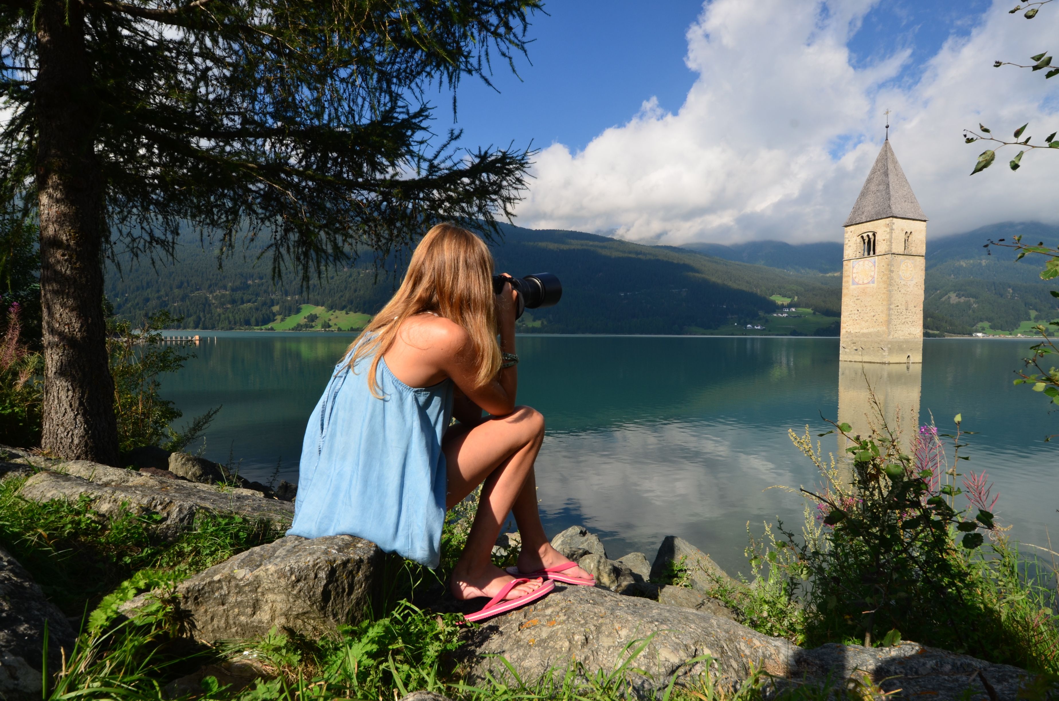
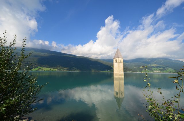
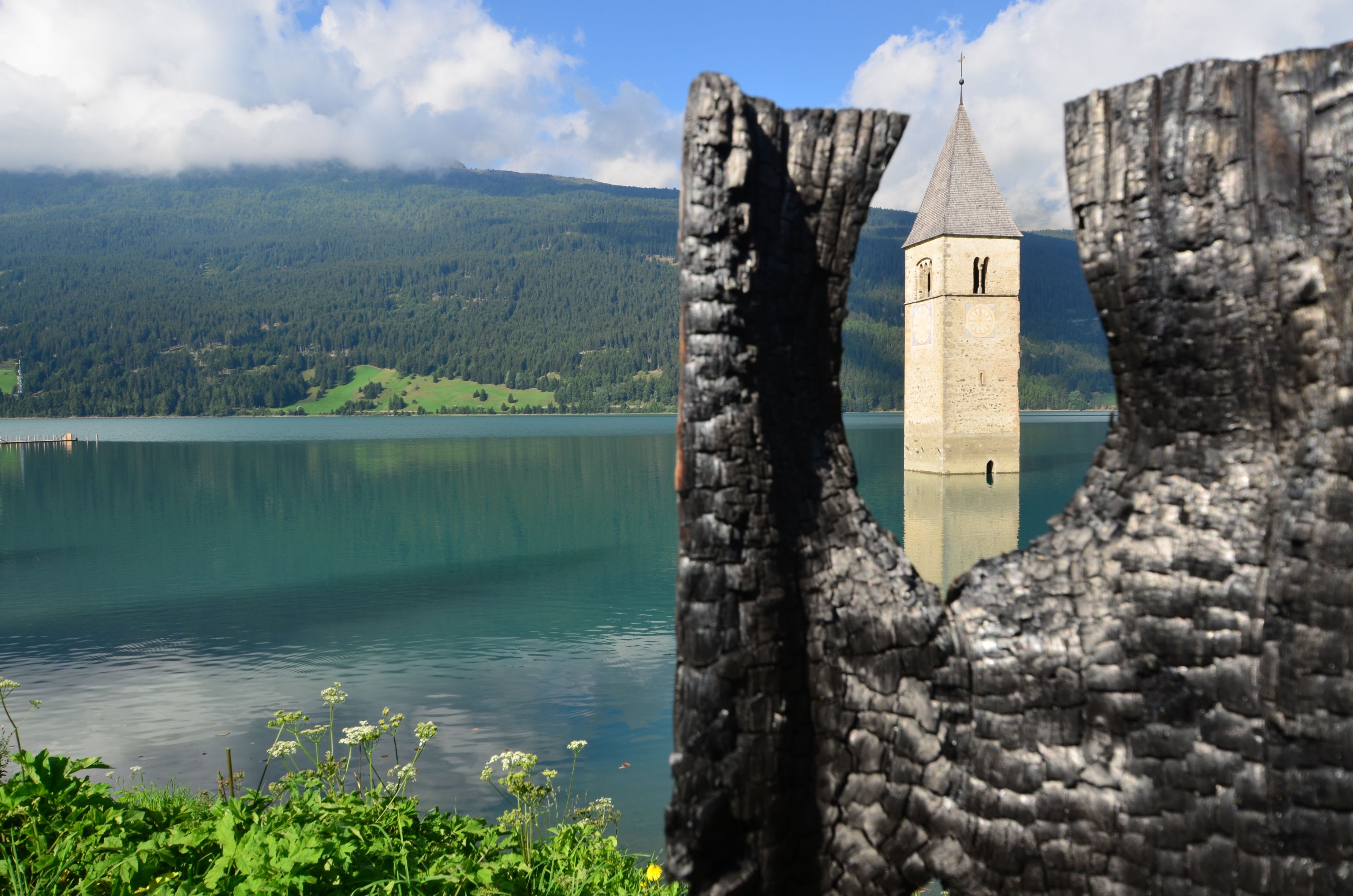
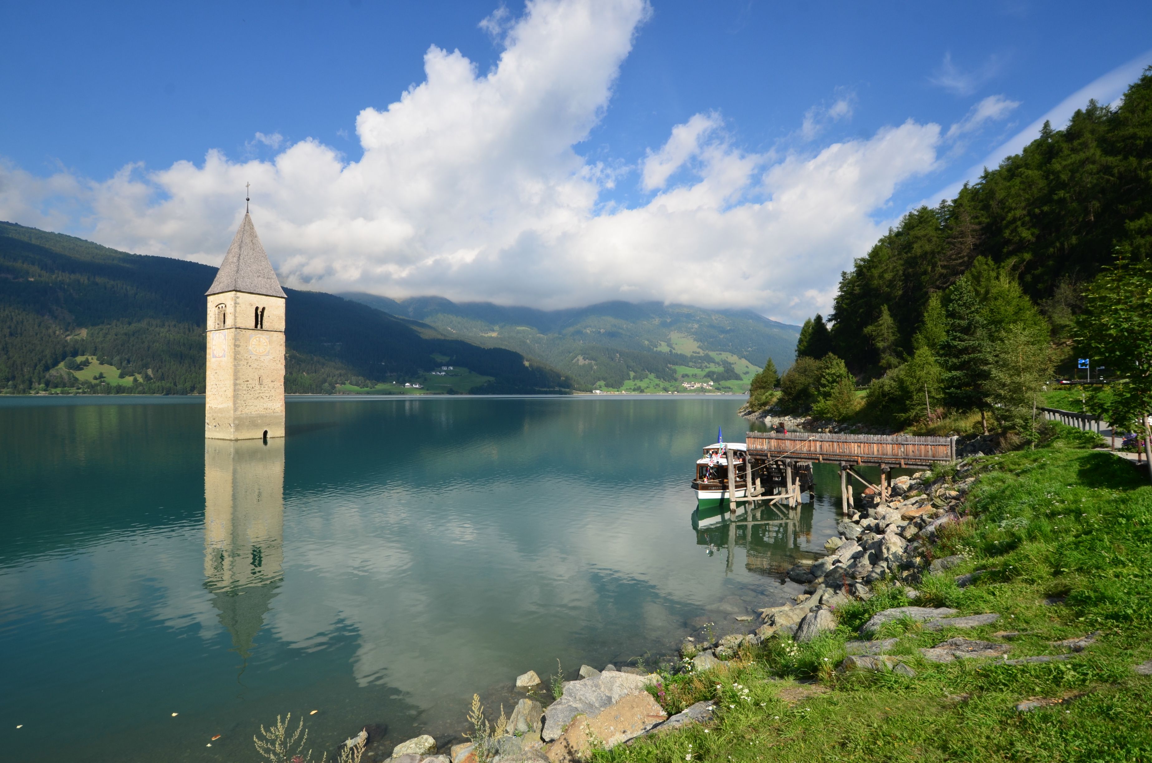
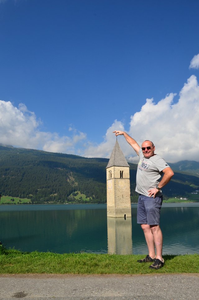
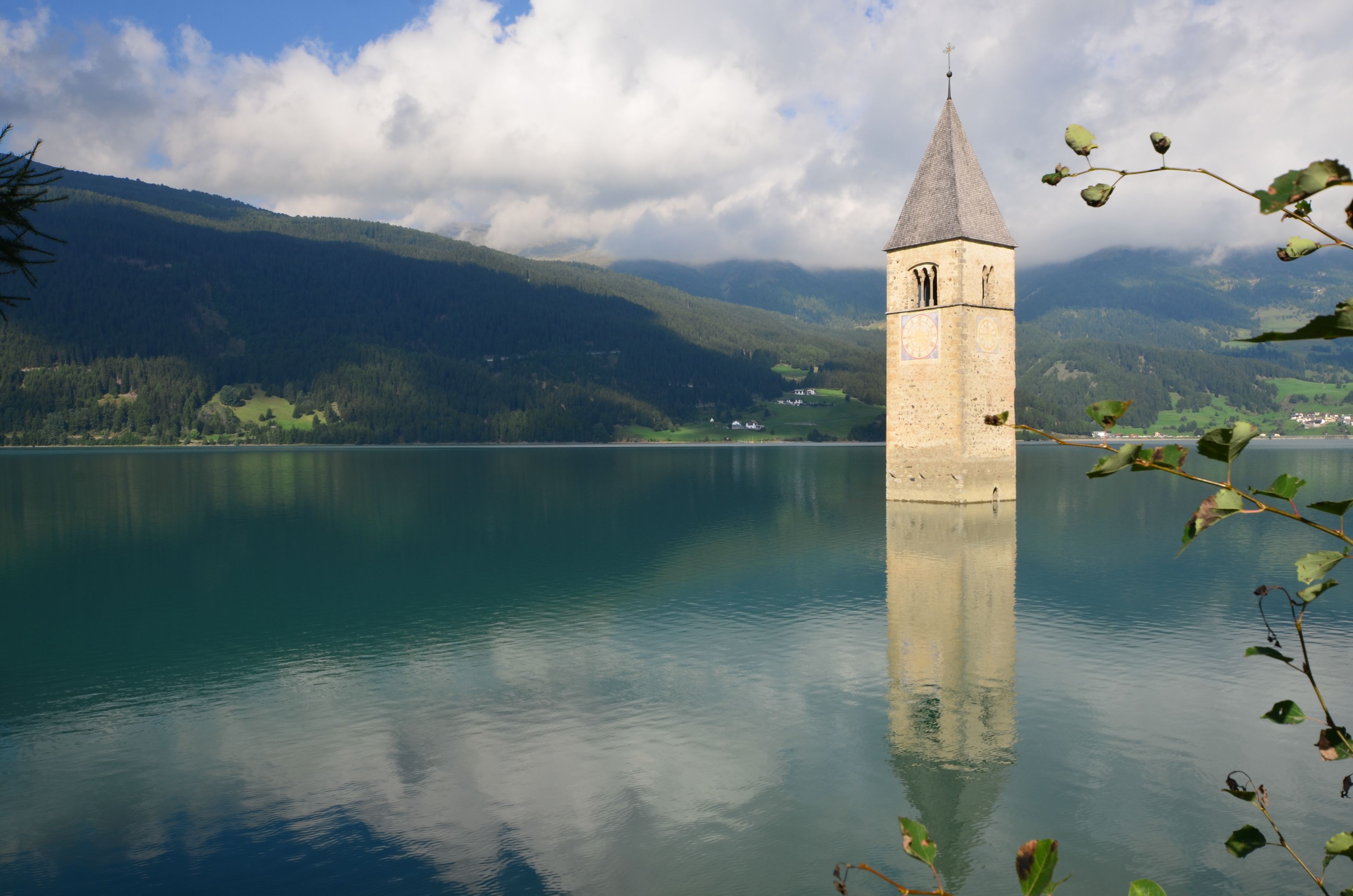
Those who come to the Reschensee are immediately struck by the church tower, which stands out of the water alone. So were we, when we stopped at that beautiful place on our way from South Tyrol, Italy to Switzerland during this years Summer holidays. This striking tower has become the landmark of the region and the whole Vinschgau region.
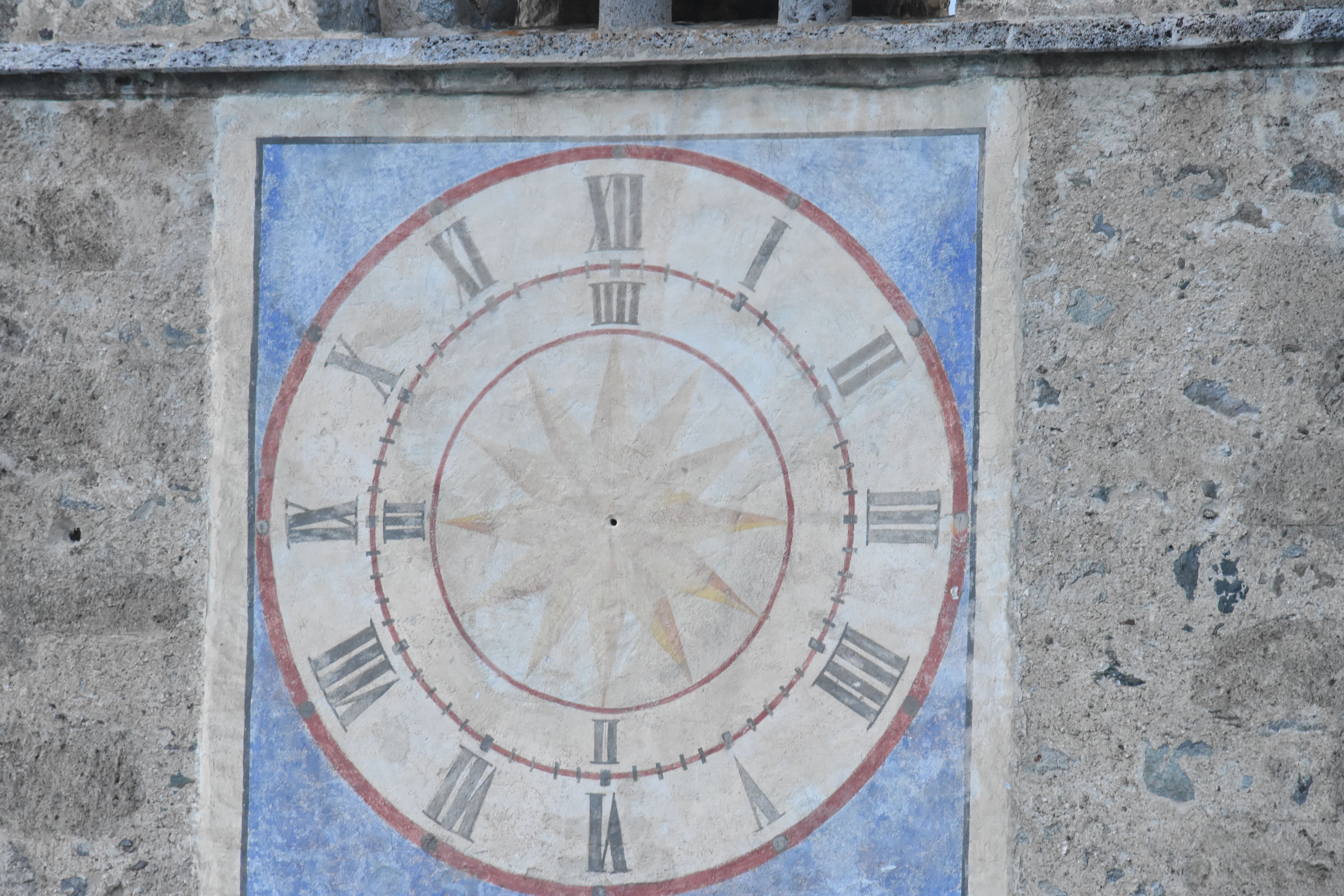
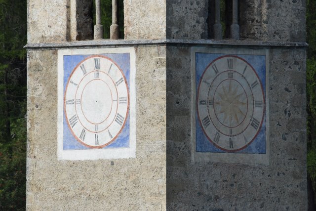
It is the Romanesque tower of the parish church of Alt-Graun, built in 1355, and it is reminiscent of this place, which was sunk here in 1950 in the floodplain of the reservoir.
Before 1950, there were three lakes on the Reschenpass: the Reschensee, the Mitter- or Grauner See and the Haidersee. Plans for a reservoir for energy production existed already in the times of the Donaumonarchy and after the First World War and the annexation of South Tyrol by Italy in 1920, were again taken up. These plans, however, being planned to be realized in a much faster time interval and with an increase of the water level by only 5 meters.
In 1939, the project was greatly expanded by the then fascist government, and the height of the dams was raised to 22 meters. One of these plans was that Graun and Reschen would be flooded completely. It was planned to expropriate and resettle the population by the means of "the national interest".
The outbreak of the Second World War delayed the implementation of the project so that the population hoped to escape the disaster of expropriation and resettlement. But as early as 1947, two years after the end of the war, the work on the reservoir was resumed. All protests and interventions remained unsuccessful, and in 1950, the locks of the dam wall were closed and Graun, the hamlets of Arlund, Piz, Gorf and Stockerhöfe as well as large parts of Altreschen disappeared forever in the waters of the reservoir. 163 houses and farm buildings were destroyed, 670 hectares of cultivated land were flooded, 150 families lost their livelihoods and were forced to migrate.
Today only a little is left of all this. The region around Lake Reschensee is a popular and thriving holiday region, the mountains invite you to go hiking and mountain biking. The round of the lake is a wonderful and much-used hiking, biking, Nordic walking and running track, the lake itself a wonderful area for fishing, boating, sailing and kite surfing.
Only the church tower of the sunken Alt-Graun, which rises from the Reschensee, testifies to the past.
We were very impressed by these facts and also how easily this fascist government at that time had decided to make all those people lose everything they had and leave them with only a puny compensation, far from being worth their losses.
I hope you like my post and wish you a very wonderful day.
Take care of yourselves,
Yours, Patrick
Liebe Steemians
Diejenigen, die zum Reschensee kommen, werden sofort den Kirchturm entdecken, der hier einsam aus dem Wasser ragt. So erging es auch uns, als wir in diesen Sommerferien, von Südtirol kommend in Richtung Schweiz fuhren.
Dieser markante Turm ist inzwischen zum Wahrzeichen der Region und der Region Vinschgau geworden.
Es ist der romanische Turm der Pfarrkirche Alt-Graun, erbaut im Jahre 1355. Er erinnert an diesen Ort, der hier 1950 in dem Wasser des Stausees versenkt wurde.
Vor 1950 gab es drei Seen auf dem Reschenpass: den Reschensee, den Mitter- oder Grauner See und den Haidersee. Pläne für ein Reservoir für die Energieproduktion existierten bereits in der Zeit der Donaumonarchie. Nach dem Ersten Weltkrieg, als Südtirols durch Italien im Jahre 1920 annektiert worden war, wurden sie wieder aufgenommen. Diese Pläne sollten jedoch in einem wesentlich schnelleren Zeitintervall realisiert werden und ausserdem lediglich eine Erhöhung des Wasserspiegels um 5 Meter mit sich bringen.
1939 wurde das Projekt von der damals faschistischen Regierung stark erweitert, und die Höhe der Dämme wurde auf 22 Meter festgelegt. Einer dieser Pläne war, dass Graun und Reschen ganz überschwemmt würden. Es war geplant, die Bevölkerung im Sinne des "nationalen Interesses" zu Enteignen und umzusiedeln.
Durch den Ausbruch des Zweiten Weltkriegs wurde die Umsetzung des Projekts verzögert, so dass die Bevölkerung hoffte, der Katastrophe der Enteignung und Umsiedlung zu entkommen. Aber schon 1947, zwei Jahre nach dem Ende des Krieges, wurde die Arbeit an dem Stausee wieder aufgenommen. Alle Proteste und Interventionen blieben erfolglos, und 1950 wurden die Schieber der Dammmauer geschlossen und Graun, die Weiler Arlund, Piz, Gorf und Stockerhöfe sowie große Teile von Altreschen verschwanden für immer in den Gewässern des Stausees. 163 Häuser und Bauernhäuser wurden zerstört, 670 Hektar kultiviertes Land wurden überschwemmt, 150 Familien verloren ihren Lebensunterhalt und wurden gezwungen, zu migrieren.
Heute ist nur noch wenig davon zu sehen. Die Region um den See Reschensee ist jetzt eine beliebte und blühende Ferienregion, die Berge laden zum Wandern und Mountainbiken ein. Die Rundung des Sees ist eine wunderbare und viel benutzte Wander-, Rad-, Nordic-Walking- und Rennrad-Strecke, der See selbst ist ein wunderschöner Ort zum Angeln, Bootfahren, Segeln und Kitesurfen.
Nur der Kirchturm des versunkenen Alt-Graun, der aus dem Reschensee aufsteigt, zeugt noch von der Vergangenheit.
Wir waren sehr beeindruckt von alledem und auch, wie leicht diese faschistische Regierung damals beschlossen hatte, all diese Menschen zu enteignen, die damit ihre Existenzen verloren, um sie dann mit einer mickrigen Entschädigung sich selbst und ihrem Schicksal zu überlassen.
Ich hoffe die Bilder gefallen Euch und wünsche Euch einen wunderschönen Tag.
Passt auf Euch auf,
Eurer Patrick
Wanna see more of my stuff? Click:
Du willst mehr von mir sehen? Click:

Du willst mehr von mir sehen? Click:
Please come and have a look at my post, little @originalworks bot.
The @OriginalWorks bot has determined this post by @pipurilla to be original material and upvoted it!
To call @OriginalWorks, simply reply to any post with @originalworks or !originalworks in your message!
To enter this post into the daily RESTEEM contest, upvote this comment! The user with the most upvotes on their @OriginalWorks comment will win!
For more information, Click Here!
Special thanks to @reggaemuffin for being a supporter! Vote him as a witness to help make Steemit a better place!
Wow... cooler Turm ;-)
Wohne nicht so weit weg, aber kannte es nicht.
Grüsse
Vielen Dank!
Hätte ich das gewusst, hätte ich Dich abgeholt und mitgenommen, Steemitri! Ein Mannequin kann doch sicher nicht selbst fahren! 😃😂😉
Traumhafte Bilder ein toller Post...Danke das uns den Geschichtlichen Hintergrund nahe gebracht hast.Ein klares upvote und resteemed. Gruß
Vielen Dank mein Freund! Das freut mich sehr!
Ein schönes Wochenende wünsche ich Dir! 😃
wow, wie schön!!! ich folge für mehr :)
Danke sehr! Das freut mich! 😃
Beautiful place! Interesting they didn't move the tower when flooding the area! Abu Simble in Egypt and whole villages in China were moved before creating water reservoirs. I must say, the tower in the water like this looks really cool!
Thank you so much!
Maybe it is what they intented: Create a cool tourist attraction. And we all were lucky, the tower was protected by preservation order, for all the rest, including the church itself had been destroyed.
Super the tower got rescued! Really cool how it looks coming out of the water! :)
What a sad story, and what an amazing sight. So many memories buried forever under the water.
Thank you Melinda!
Yes it must have been sad times for the people there. While reseaching yesterday, I even found a story of a dog who swam serveral times onto the new lake to search his home. His people always had to take him back with a boat.
Danke für die Hintergrundinformationen zu dieser Touristenattraktion!
Die Fotos sind großartig, der Kirchturm sehr effektvoll in Szene gesetzt!
Vielen Dank! Freut mich sehr, wenn es Dir gefällt! :)
those pictures are amazing, I have never seen anything like that before!!
Thank you so much, Shaun! Yes it is indeed a very special place. 😃
a sad story at this place. photos are wonderful
Thank you so very much, Tali!
Yes, it's a sad story indeed! Today it's a tourist attraction. I wonder if many of them know the tragedy that happend there in 1950.
Have a great day, my friend! :)
Thank you! and you too!
Wow, what a nice place and thanks you pulled the tower out of the water!.
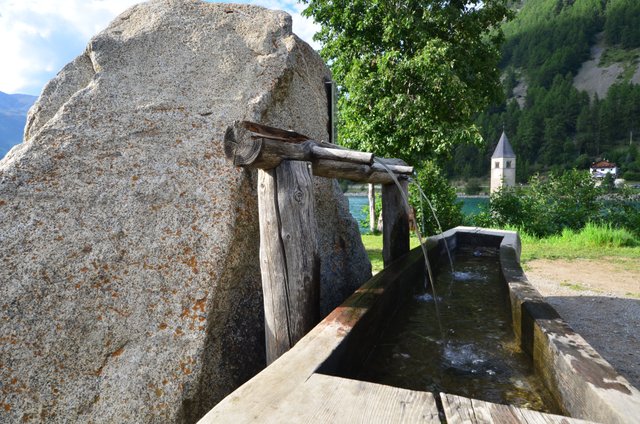
The old waterplace is in this post my favourite. Thanks again for sharing a bit from your day.
Thanks to you, my friend! You surely can imagine how hard it was to hold the steeple out of the water. 😃😂